Log in
All resources
Create a design
480 Free Images of 1865 Maps
gemeente atlas van nederland - south holland
1860s maps of south holland
gemeente atlas van nederland - north holland
1860s maps of north holland
19th-century maps of rotterdam
jacob kuyper
gemeente atlas van nederland - zeeland
maps of polders in zeeland
goeree-overflakkee in the 19th century
gemeente atlas van nederland - north brabant
gemeente atlas van nederland - south holland
1860s maps of south holland
gemeente atlas van nederland - south holland
1860s maps of south holland
gemeente atlas van nederland - south holland
19th-century maps of rotterdam
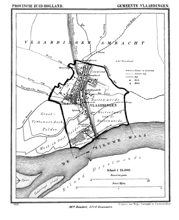
gemeente atlas van nederland - south holland
old maps of vlaardingen
gemeente atlas van nederland - south holland
1860s maps of south holland
gemeente atlas van nederland - south holland
1860s maps of south holland
gemeente atlas van nederland - south holland
1860s maps of south holland
gemeente atlas van nederland - south holland
maps of nieuwenhoorn
gemeente atlas van nederland - north holland
old maps of haarlem
gemeente atlas van nederland - south holland
19th-century maps of rotterdam
gemeente atlas van nederland - south holland
1860s maps of south holland
gemeente atlas van nederland - south holland
19th-century maps of rotterdam
gemeente atlas van nederland - south holland
1860s maps of south holland
gemeente atlas van nederland - south holland
1860s maps of south holland
gemeente atlas van nederland - south holland
1860s maps of south holland
gemeente atlas van nederland - south holland
strevelshoek
gemeente atlas van nederland - gelderland
varsseveld
gemeente atlas van nederland - south holland
1860s maps of south holland
gemeente atlas van nederland - south holland
maps of goudswaard
gemeente atlas van nederland - south holland
maps of lisse
gemeente atlas van nederland - south holland
maps of heerjansdam
gemeente atlas van nederland - south holland
1860s maps of south holland
gemeente atlas van nederland - south holland
maps of alkemade
gemeente atlas van nederland - south holland
maps of zuid-beijerland
old maps of schagen
maps of zijpe
gemeente atlas van nederland - south holland
1860s maps of south holland
gemeente atlas van nederland - south holland
1860s maps of south holland
gemeente atlas van nederland - south holland
maps of delfshaven
gemeente atlas van nederland - north holland
old maps of haarlem
gemeente atlas van nederland - north holland
maps of bloemendaal
gemeente atlas van nederland - north holland
maps of zandvoort
gemeente atlas van nederland - south holland
maps of ameide
gemeente atlas van nederland - south holland
maps of haastrecht
gemeente atlas van nederland - south holland
1860s maps of south holland
gemeente atlas van nederland - south holland
1860s maps of south holland
gemeente atlas van nederland - north holland
old maps of haarlem
gemeente atlas van nederland - south holland
old maps of delft
gemeente atlas van nederland - south holland
1860s maps of south holland
gemeente atlas van nederland - north holland
maps of bergen, north holland
gemeente atlas van nederland - south holland
1860s maps of south holland
gemeente atlas van nederland - south holland
1860s maps of south holland
gemeente atlas van nederland - north holland
19th-century maps of amsterdam
gemeente atlas van nederland - south holland
old maps of eiland van dordrecht
19th-century maps of russia
russia in the 1860s
gemeente atlas van nederland - south holland
1860s maps of south holland
gemeente atlas van nederland - south holland
maps of maasdam
maps of nieuwpoort, south-holland
vestingwerken nieuwpoort
gemeente atlas van nederland - south holland
1860s maps of south holland
the loyal west in the times of the rebellion
1803 maps of the united states
gemeente atlas van nederland - south holland
giessen (river south-holland)
gemeente atlas van nederland - south holland
giessen (river south-holland)
gemeente atlas van nederland - south holland
1860s maps of south holland
maps of nieuw-helvoet
nieuw-helvoet
gemeente atlas van nederland - north brabant
huisseling
gemeente atlas van nederland - north brabant
herpen
gemeente atlas van nederland - south holland
19th-century maps of rotterdam
maps of polders in zeeland
maps of terneuzen
gemeente atlas van nederland - north brabant
maps of willemstad, north brabant
gemeente atlas van nederland - north holland
old maps of amsterdam
gemeente atlas van nederland - south holland
1860s maps of south holland
gemeente atlas van nederland - south holland
1860s maps of south holland
gemeente atlas van nederland - south holland
maps of geervliet
gemeente atlas van nederland - north holland
maps of kwadijk
gemeente atlas van nederland - south holland
19th-century maps of rotterdam
gemeente atlas van nederland - south holland
maps of zoeterwoude
gemeente atlas van nederland - south holland
1860s maps of south holland
gemeente atlas van nederland - south holland
1860s maps of south holland
gemeente atlas van nederland - north holland
bennebroek
the loyal west in the times of the rebellion
1865 maps of the united states
history of alphen aan den rijn
maps of aarlanderveen
gemeente atlas van nederland - north holland
maps of texel
gemeente atlas van nederland - south holland
maps of zoetermeer
gemeente atlas van nederland - south holland
1860s maps of south holland
old maps of koedijk
old maps of alkmaar
gemeente atlas van nederland - south holland
old maps of leiden
gemeente atlas van nederland - south holland
old maps of gouda
gemeente atlas van nederland - south holland
old maps of gouda
gemeente atlas van nederland - south holland
polytechnische school te delft
gemeente atlas van nederland - south holland
maps of groot-ammers
gemeente atlas van nederland - zeeland
maps of oud-vossemeer
gemeente atlas van nederland - south holland
maps of kedichem
gemeente atlas van nederland - south holland
1860s maps of south holland
gemeente atlas van nederland - south holland
1860s maps of south holland
gemeente atlas van nederland - south holland
1860s maps of south holland
gemeente atlas van nederland - north holland
maps of texel
gemeente atlas van nederland - south holland
1860s maps of south holland
gemeente atlas van nederland - south holland
1860s maps of south holland
gemeente atlas van nederland - north holland
maps of uithoorn
old maps of the dutch gold coast
willem cornelis van baarsel
gemeente atlas van nederland - north holland
old maps of alkmaar
maps of polders in zeeland
old maps of sluis
gemeente atlas van nederland - north holland
blokker
maps of polders in zeeland
old maps of sluis
maps of polders in zeeland
maps of terneuzen
maps of polders in zeeland
old maps of sluis
gemeente atlas van nederland - south holland
1860s maps of south holland
gemeente atlas van nederland - south holland
1860s maps of south holland
gemeente atlas van nederland - south holland
1860s maps of south holland
gemeente atlas van nederland - south holland
maps of zegwaart
gemeente atlas van nederland - north brabant
bokhoven
101 - 200 of 480
Next page
/ 5